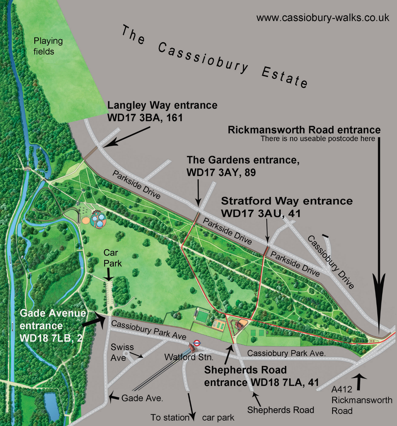
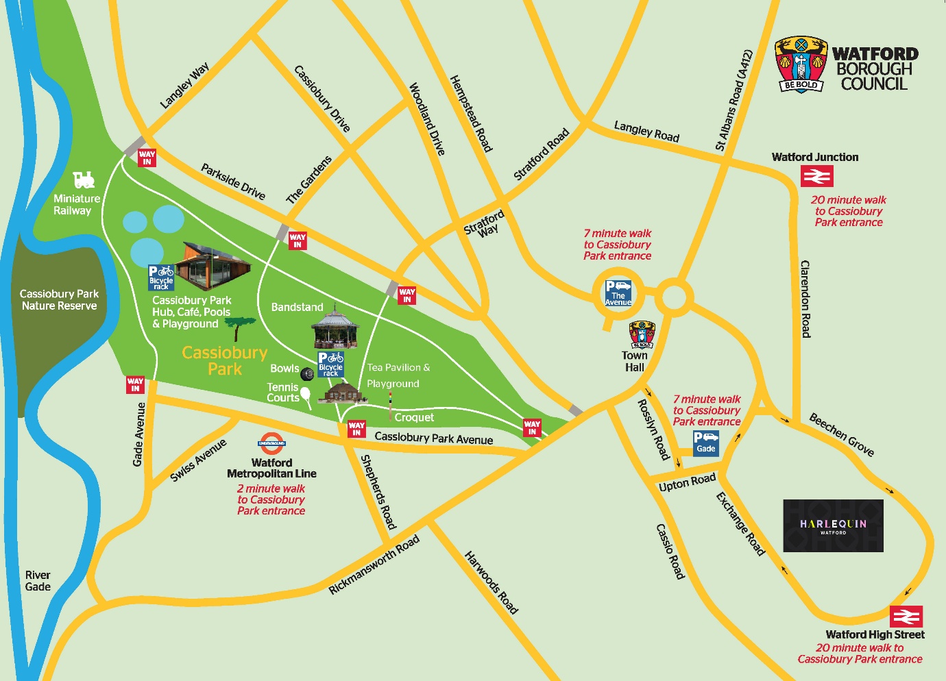
Scroll to the bottom for maps.
LOCATION
Watford is in Hertfordshire, England, close to the border with London.
Immediate suburbs: Croxley, Nascot Wood, Oxhey, Hollywell, Bushey, Garston.
A 10 to 15 minute drive: Rickmansworth, Kings Langley, Leavesden, Northwood.
About a 20mn drive: Radlett, St Albans, Hemel Hempstead, Hatch End, Pinner.
However, from London on a fast road (A41 or M1) and in light traffic it’s only twenty minutes all the way from Hendon and Mill Hill.
SIZE
Cassiobury Park covers 190 acres (including its nature reserves). Adjoining the park (just the other side of a golf course) is Whippendell Wood (165 acres). If you add the two smaller woods next to Whippendell Wood, plus the golf course and the woodland alongside the canal, you have over 500 acres of publicly-accessible countryside. For the sake of this website my directions concern only Cassiobury Park and the walk is through Cassiobury Park and Whippendell wood.
NEW WEBSITE
This site was originally created in 2013 to promote my book, Cassiobury Walks (30 walks from Cassiobury Park). In August 2026 the website was hacked and compromised, and we had to delete it. So this is a brand new website.
As of now (November 2026) it is not entirely rebuilt, I have yet to make many tweaks (and to finish the directions for the walk!). It should be complete by Christmas.
THE BOOK
Cassiobury Walks is now out of print. The print-run was 500 and, to my amazement, all 500 sold out quite quickly. Dozens of people have since been asking when I’ll write another book of walks. I do not have such a book planned…maybe when I retire from my day job.
If you wish to hunt around for a second hand copy, details are:
Title: Cassiobury Walks
Author: Raffi Katz
Publisher: Quickest (2013)
ISBN 978-0-9512095-4-7
Format: softback, 104 pages, 12X17cm
CONTACT
raffi[at]cassiobury-walks.co.uk